Digital Documentation, Mapping, and Interpretation
The Project
The Bell Island Expedition is a Canadian-led initiative to document and interpret the wrecks sunk during the German submarine attacks of 1942, and to present them within a unified wartime landscape.
Rather than treating each wreck or site in isolation, the Virtual Memorial enables the Bell Island battlefield to be understood spatially—linking events at sea to the shoreline, industrial infrastructure, and the community that witnessed the attacks.
The result is not simply a record of individual shipwrecks, but the reconstruction of a Battle of the Atlantic battlefield as a connected historical environment.
A Connected Battlefield
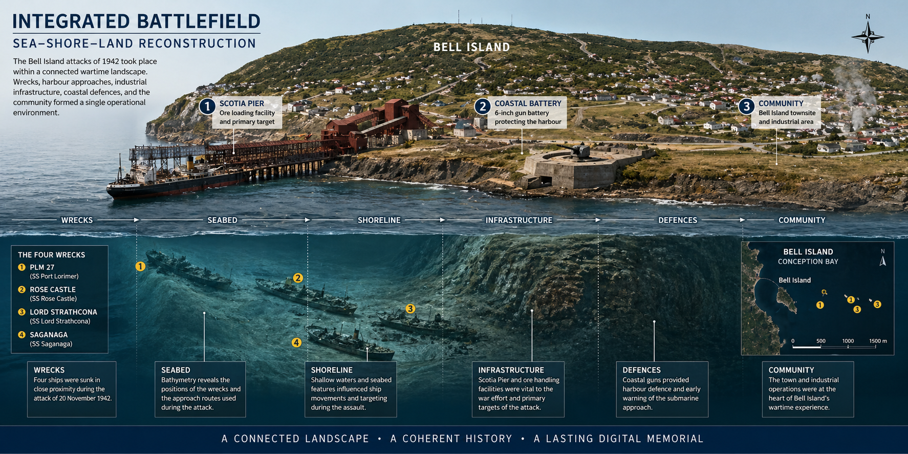
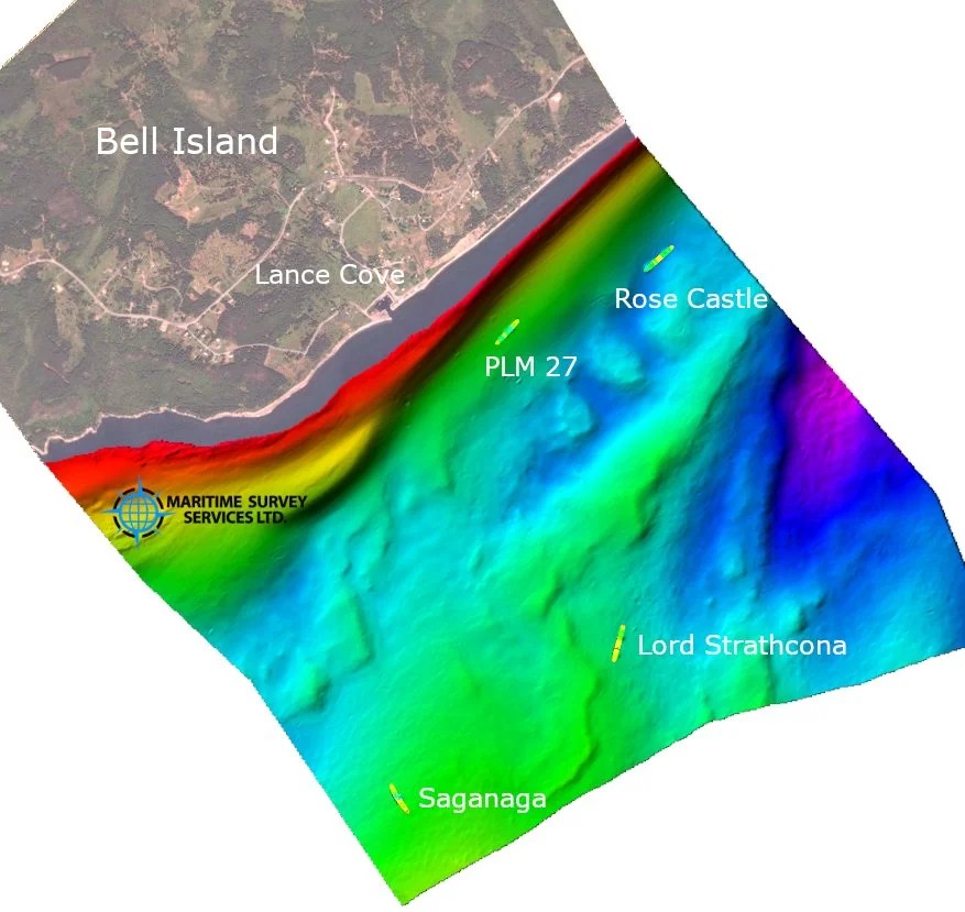
The four ships sunk at Bell Island lie within close proximity to one another and to surviving wartime features on land. This concentration creates a rare opportunity: to understand a naval engagement not as dispersed events across an ocean, but as a defined and coherent landscape.
Within this setting, wrecks, harbour approaches, coastal defensive positions, industrial infrastructure, and memorial sites can be examined together. The relationships between these elements reveal how the events of 1942 unfolded across both sea and shore, linking naval operations directly to the industrial and human context in which they occurred.
Together, these elements form one of the most complete surviving naval battle landscapes in North America.
What the Virtual Memorial Provides
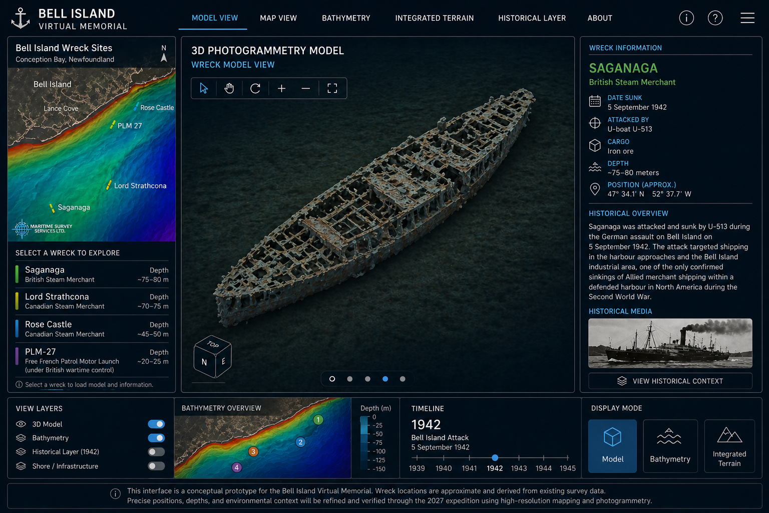
The Bell Island Virtual Memorial will result in a permanent digital reconstruction of the battlefield, designed for exploration, research, and public interpretation.
This includes:
- A unified three-dimensional representation of the Bell Island battlefield
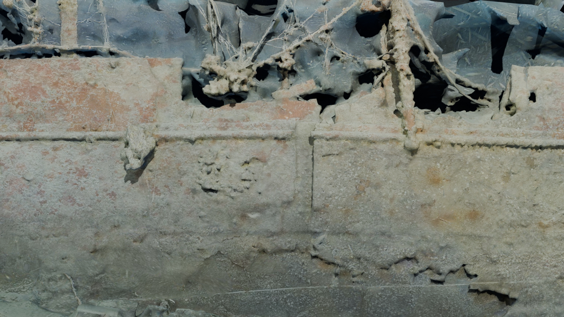
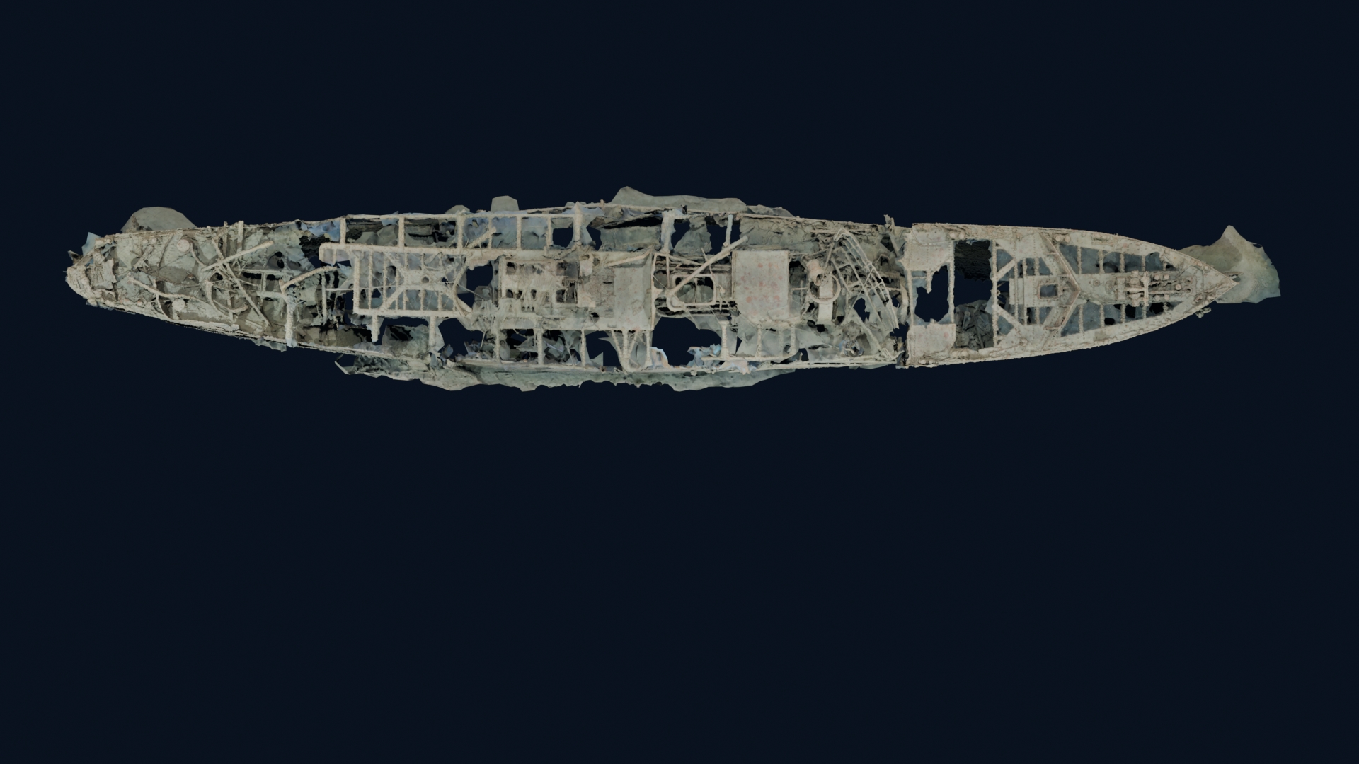
- Detailed digital models of each wreck site
- Spatial visualization linking seabed, shoreline, and land-based infrastructure
- A long-term record supporting archaeological and environmental research
- Interpretive material for museum, educational, and public use
For the first time, the Bell Island attacks will be experienced as a coherent spatial environment, allowing users to understand how geography, industry, and naval operations intersected during the events of 1942.
From Documentation to Interpretation
The significance of the Virtual Memorial lies not only in recording the sites, but in making their relationships understandable.
Naval warfare is inherently difficult to interpret. Evidence is distributed, often inaccessible, and rarely experienced as a whole. By reconstructing the Bell Island battlefield as a unified digital environment, the Virtual Memorial allows spatial relationships to become clear—linking ship positions, attack patterns, industrial activity, and human response.
This approach transforms documentation into interpretation, enabling the site to be explored as a complete historical landscape rather than a series of disconnected locations.
Foundations in Previous Expeditions
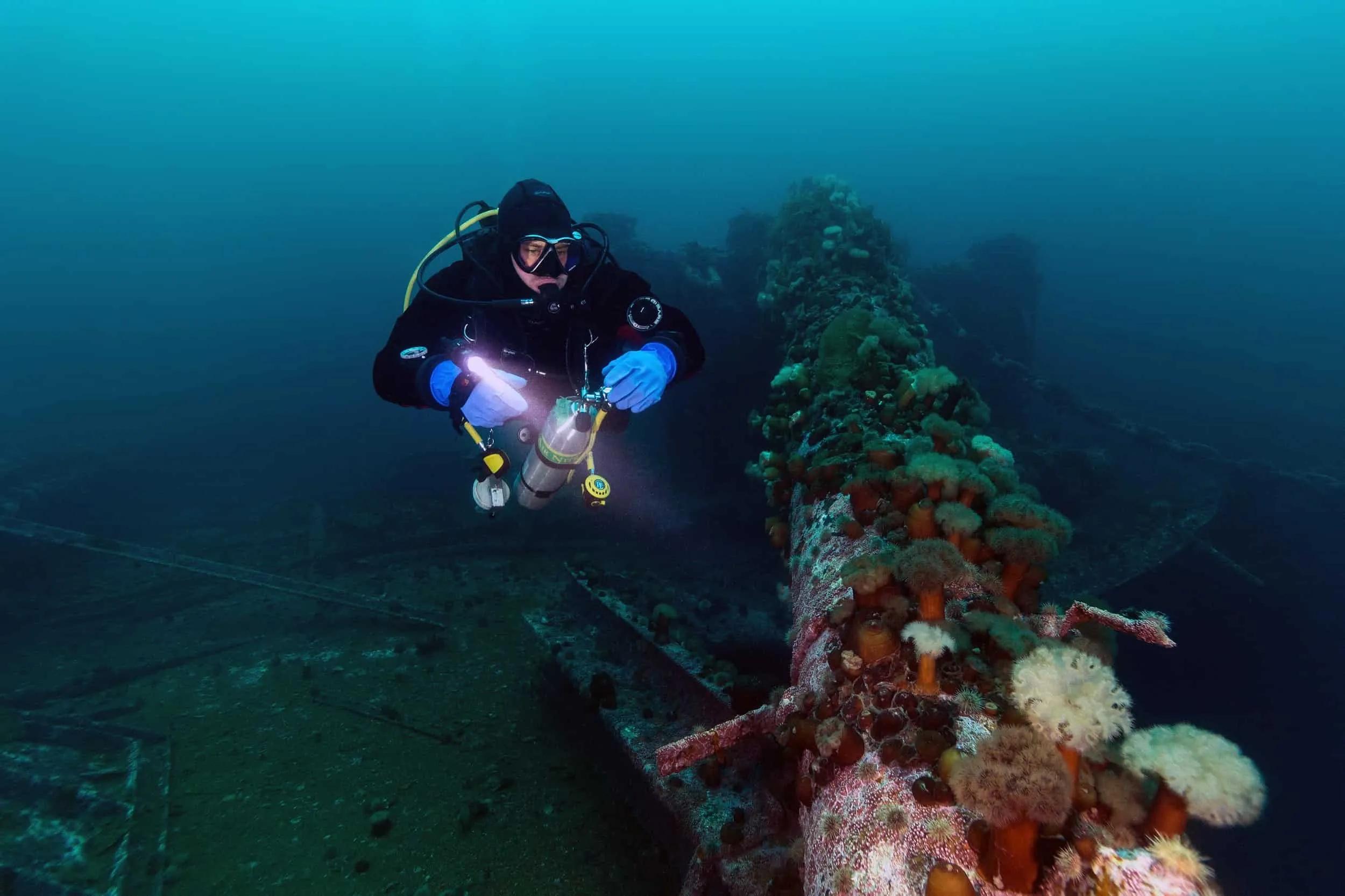
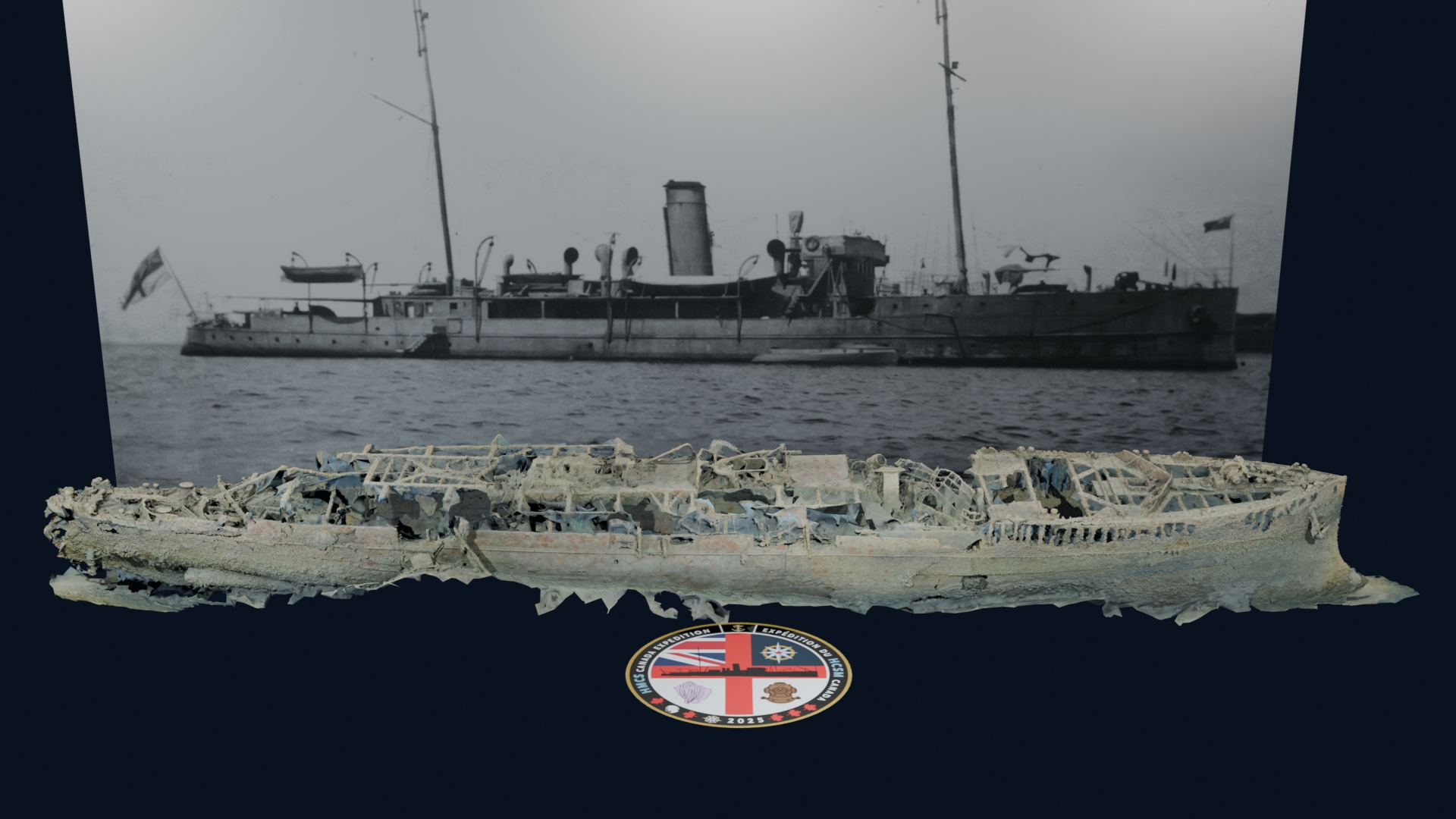
The Bell Island Virtual Memorial builds directly on the methodology developed during the HMCS Canada Expedition, which produced the first complete three-dimensional record of Canada’s first purpose-built warship.
That expedition demonstrated how high-resolution imaging and digital reconstruction can:
- Document complex wreck sites without disturbance
- Support archaeological and ecological analysis
- Make underwater heritage accessible to a global audience
Members of the expedition team also participated in the 2016 Battle of the Atlantic expedition led by the National Oceanic and Atmospheric Administration, which combined historical research, seafloor mapping, and high-resolution imaging to document wartime wrecks such as the German submarine U-576 and the freighter Bluefields.
The Bell Island project extends these approaches from individual wreck documentation to the reconstruction of an entire battlefield landscape.
An Evolving Digital Platform
The Bell Island Virtual Memorial is designed to develop over time as additional material is incorporated.
Future development may include:
- Interactive maps of North Atlantic convoy routes
- Expanded three-dimensional models of additional sites
- Integration of archival photographs and documents
- Cartographic reconstruction of wartime bases and infrastructure
- Educational resources for students and researchers
Future phases will expand this foundation to include a comprehensive interpretation of the North Atlantic system and the global naval war, placing Bell Island within the full operational and strategic framework of the Second World War.
A Long-Term Documentation Project
The Bell Island Expedition 2027 represents the first stage of a multi-year effort to document and interpret one of the most important integrated naval battlefields of the Second World War.
By combining history, maritime archaeology, marine science, and advanced imaging technologies, the Virtual Memorial will create a lasting digital record that remains accessible to researchers, students, and the public.
As this work continues, Bell Island will serve as the foundation for a broader interpretive framework—linking Newfoundland and Labrador, Canada, and the wider Atlantic world within the global history of the Battle of the Atlantic.