Documenting and Interpreting the Bell Island Battlefield
Expedition Objectives
The Bell Island Battle of the Atlantic Expedition is designed to document, interpret, and make accessible one of the most intact Second World War naval battle landscapes in North America.
The project brings together underwater archaeology, marine science—including marine biology and environmental study—advanced imaging technologies, and historical research to produce a comprehensive digital record of the 1942 attacks and their wider operational and geographic context within the Battle of the Atlantic, while also supporting responsible heritage interpretation and long-term scientific study in Newfoundland and Labrador.
Creation of a High-Resolution Digital Terrain Model (DTM)
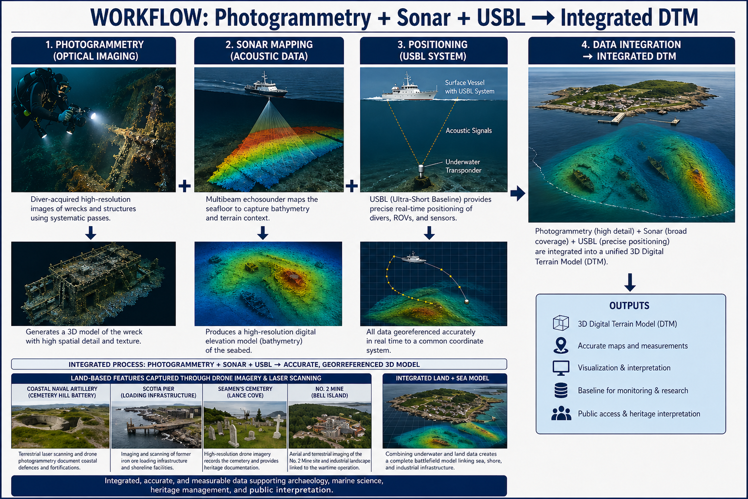
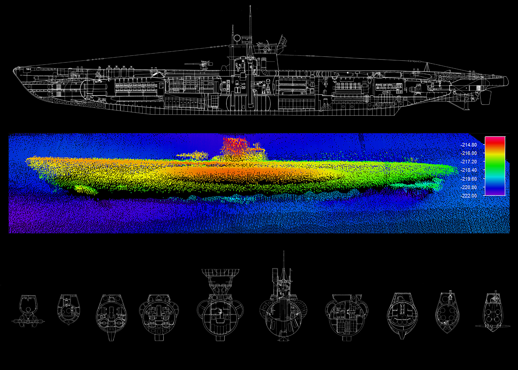
At the core of the expedition is the development of a fully integrated three-dimensional Digital Terrain Model (DTM) of the Bell Island battlefield.
This model will combine:
High-resolution photogrammetry of all four wrecks:
- Saganaga (British)
- Lord Strathcona (Canadian)
- Rose Castle (Canadian)
- PLM-27 (Free French under British wartime control)
Multibeam and acoustic mapping of the surrounding seafloor
Precise georeferencing using USBL positioning systems
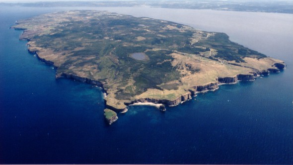
Aerial drone imaging conducted by a licensed operator from Memorial University’s Marine Institute, providing high-resolution coverage of:
- The wreck sites and surrounding waters in Conception Bay
- Scotia Pier and the former loading infrastructure
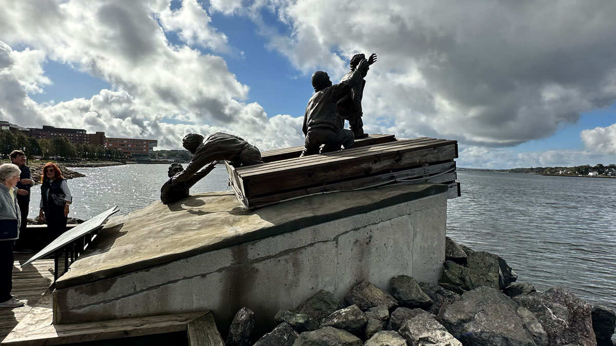
- The Seamen’s Cemetery at Lance Cove
- The Cemetery Hill / Coastal Road artillery battery
- The Bell Island Community Museum and No. 2 Mine
Terrestrial laser scanning of:
- The Cemetery Hill coastal artillery battery
- The remains of Scotia Pier
- The Seamen’s Cemetery at Lance Cove
The result will be a unified digital reconstruction of the battlefield—linking seabed, shoreline, and land-based wartime infrastructure into a single coherent spatial model.
Underwater Archaeological Documentation and Site Condition Assessment
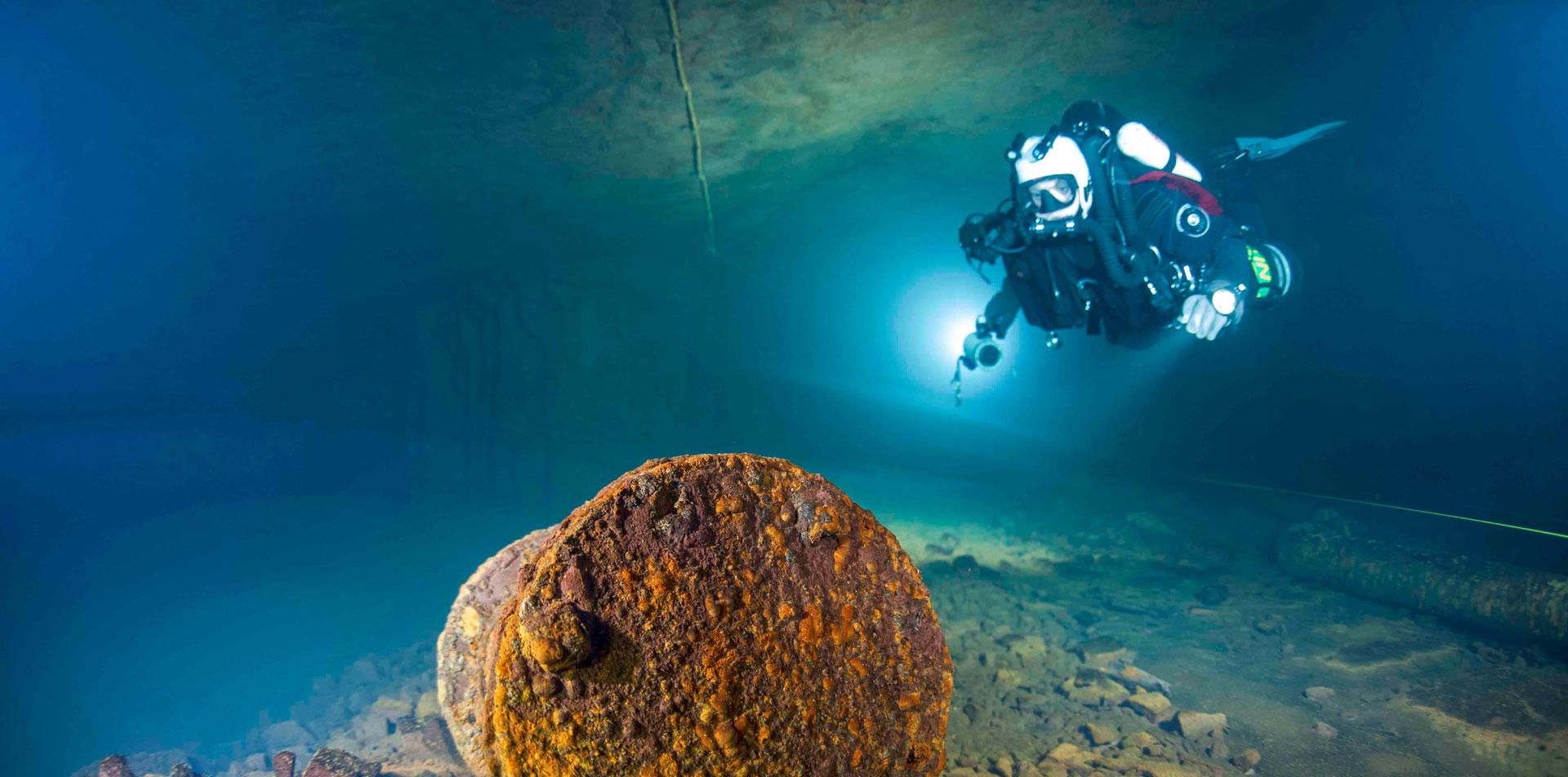
The expedition will conduct systematic, non-intrusive archaeological recording of the wrecks.
This includes:
- Structural documentation of hulls, cargo remains, and damage patterns
- Identification of torpedo impact points and blast effects
- Assessment of site integrity and long-term preservation conditions
- Comparative analysis between wrecks from the September and November 1942 attacks
In addition to documentation, the expedition will establish a baseline record of the physical condition of each vessel. This will provide a reference for future monitoring of structural change, material degradation, and site evolution over time.
All work will be conducted in accordance with established underwater cultural heritage protocols, ensuring that the sites are documented but not disturbed.
The expedition is undertaken in consultation with the Shipwreck Preservation Society of Newfoundland and Labrador, ensuring alignment with provincial heritage practices and community interests.
Marine Ecology and Environmental Baseline Study
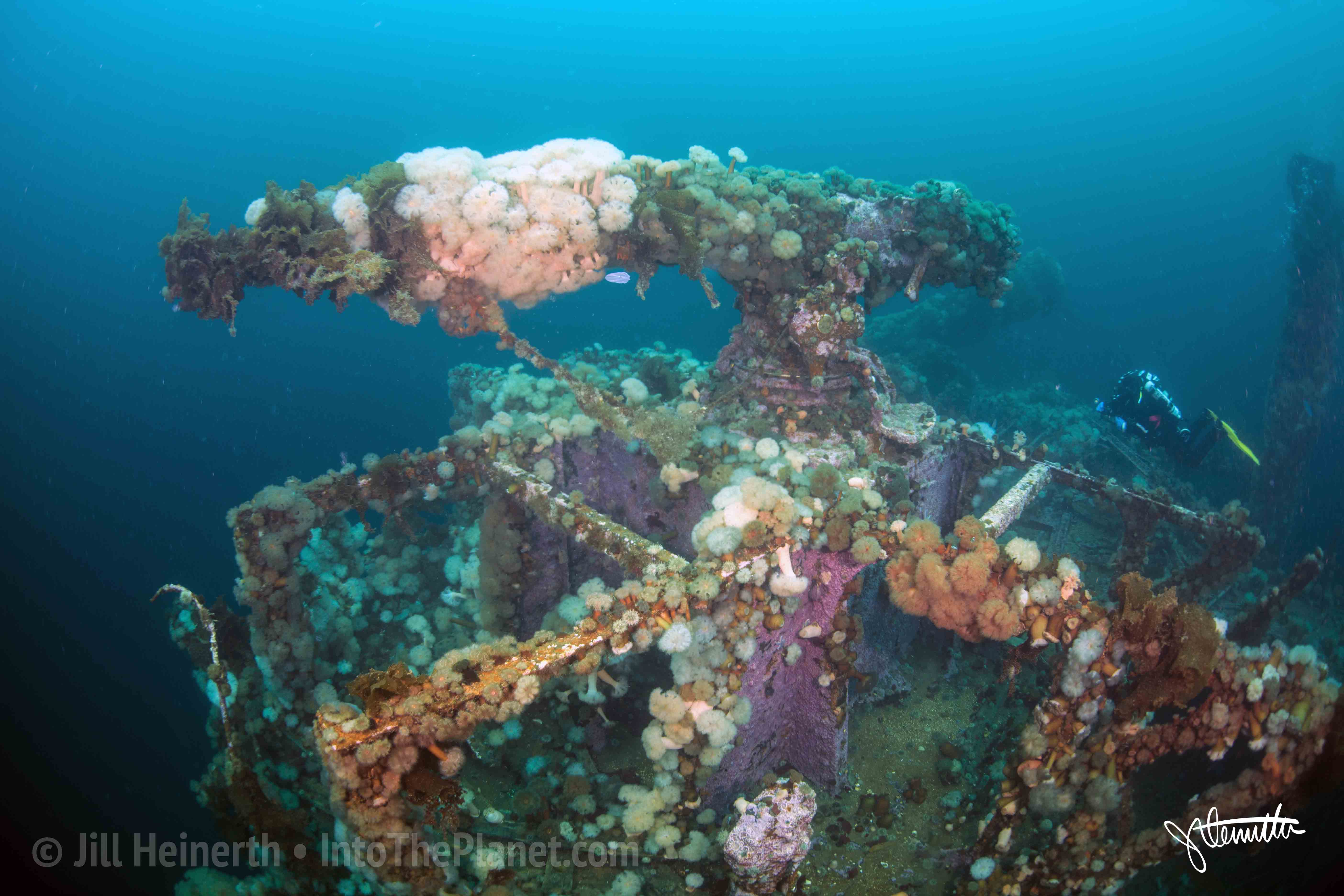
After more than eighty years on the seabed, the wrecks have become established artificial reef systems within Conception Bay.
The expedition will document:
- Species presence and biodiversity associated with each wreck
- Structural habitat complexity and ecological variation between sites
- Environmental indicators, including water temperature and biological distribution
This work will establish a baseline dataset for long-term environmental monitoring, supporting future research into ecological change and the interaction between marine environments and submerged cultural heritage.

Technology Demonstration and Method Development
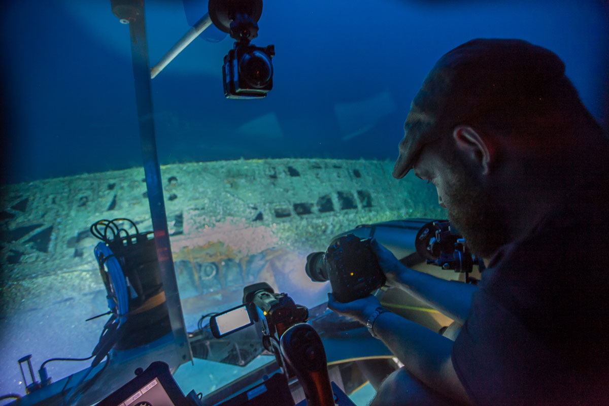
A key objective of the expedition is to evaluate and refine advanced marine imaging technologies in a complex, cold-water North Atlantic environment.
This includes:
- Diver-based photogrammetry using high-resolution imaging systems
- Deployment of stereo camera platforms and autonomous or semi-autonomous survey systems
- Integration of optical, acoustic, and positioning data into a unified geospatial model
Particular emphasis will be placed on comparing diver-acquired datasets with those generated by remotely operated systems, informing best practices in underwater documentation and digital reconstruction.
Integration of Sea, Shore, and Industrial Landscape
Unlike most naval engagements, the Bell Island attacks occurred within a defended industrial harbour.
The expedition will therefore integrate:
- The wrecks on the seabed
- Coastal defensive positions
- Industrial infrastructure linked to iron ore loading and export
- The surrounding community landscape
This approach treats Bell Island not as a collection of isolated sites, but as a complete wartime system in which industry, geography, and naval conflict intersect.
Public Interpretation and Digital Access
A central goal of the project is to make this history accessible to Canadians and an international audience.
Outputs will include:
- An interactive three-dimensional digital model accessible online
- Visualizations for museum and educational use
- Interpretive materials linking Bell Island to the wider Battle of the Atlantic
- On-site interpretive potential, including QR-linked access points
The project supports the responsible development of heritage tourism in Newfoundland and Labrador by connecting Bell Island to related wartime sites across the province, including St. John’s Harbour, Signal Hill, Cape Spear, Argentia, and Gander, as well as smaller communities associated with radar, weather, and coastal defence operations.
Training and Academic Collaboration
The expedition will support the involvement of students and researchers through Memorial University’s Marine Institute.
This includes:
- Participation in field operations
- Exposure to advanced survey and imaging technologies
- Integration of expedition data into academic research projects
The project serves as both a documentation initiative and a training platform for the next generation of marine scientists and archaeologists.
Contribution to National Commemoration
The Bell Island attacks represent one of the few instances of direct enemy action within Canadian waters during the Second World War.
By documenting and interpreting this site, the expedition contributes to:
- Recognition of the Royal Canadian Navy, the Merchant Navy, Allied seafarers, and the Royal Canadian Air Force
- Greater public understanding of Canada’s and Newfoundland’s—then a separate Dominion—role in the Battle of the Atlantic
- The creation of a meaningful and enduring digital memorial
Looking Ahead
The Bell Island Expedition 2027 represents the foundation of a long-term effort to document, understand, and interpret Canada’s wartime heritage in its full geographic context—from seabed to shoreline to inland infrastructure.
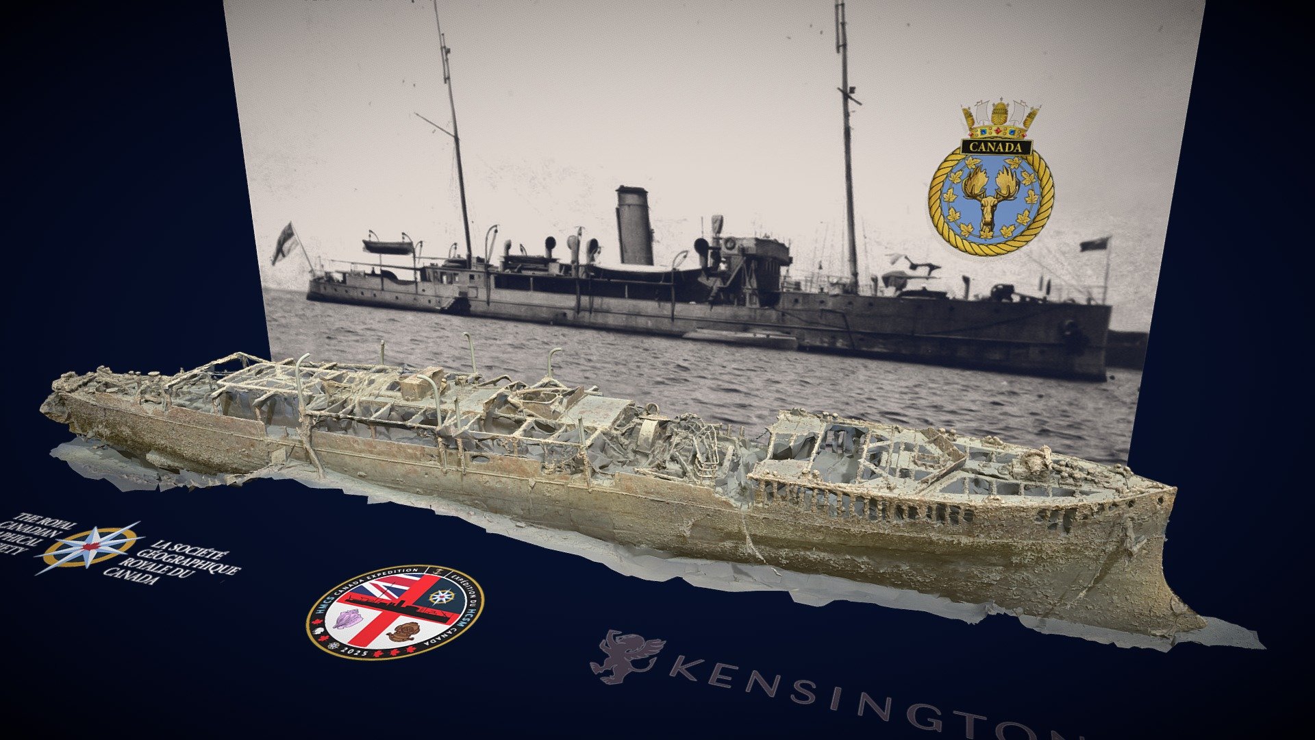
Building on approaches developed during NOAA’s 2016 Battle of the Atlantic expedition and the HMCS Canada Expedition 2025, this project extends integrated documentation methods to a larger and more complex battlefield environment, linking scientific research, historical interpretation, and commemoration within the broader North Atlantic system.